
EM3050 Activity: Map your Watershed
Where do you live in the Concord River Watershed?
The USGS (United States Geological Survey) defines a watershed as “an area of land that drains all the streams and rainfall to a common outlet such as the outflow of a reservoir, mouth of a bay, or any point along a stream channel. Watersheds can be as small as a footprint or large enough to encompass all the land that drains water into rivers that drain into the ocean.” (To make your own watershed, see activity extension below.)
OBJECTIVES
To learn the meaning of the watershed concept: to practice map-finding skills; to raise awareness of local waterways, their source and destination; to connect community members to local and national resources.
MATERIALS
Phone or computer
Access to google maps helpful, but paper maps are great too!
Access to Town of Concord GIS map webpage, optional but fun and informative
Printer, helpful but not required
For optional extension activity: Aluminum foil, various liquids, food coloring
STEPS
- Where do you live? What are your three your closest waterways/bodies of water? Mark these on your map.
- Where does that water come from (runoff, feeder creeks, ponds, artesian spring)? Try to mark sources/flows on your map.
- Where and how do they contribute to the Sudbury, Assabet, or Concord Rivers? Follow flow into one of these rivers – you may see that your neighborhood stream flows into another stream before joining one of the rivers.
- Follow the river flow to the Merrimack River and on to the ocean.
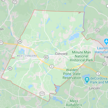
- Google maps can help you locate yourself and nearby water. But check out these very cool maps on the Town of Concord Geographic Information systems (GIS) webpage which identify the names of the ponds, creeks and rivers.
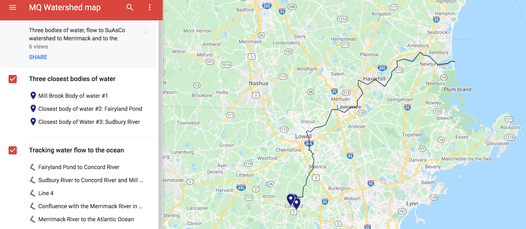
Here’s our map at Musketaquid – 40 Stow Street Concord. We highlighted the 3 closest bodies of water and followed their flow into the SuAsCo watershed and on to the Merrimack and to the ocean. You can access our map with this link. We used Google Map’s “My Map,” which was fun to play and create with!
PROJECT EXTENSION: MAKE YOUR OWN WATERSHED
- Tear off a sheet of aluminum foil twice as tall and wide as your hand.
- Spread the fingers of one hand, and lay the center of the sheet over that hand.
- Press the foil between your outspread fingers, making valleys. Your fingers will be mountain ridges. Your palm will end up being a wetland or estuary that empties into the ocean.
- Lay your shaped foil in a pan or open container, making sure that the fingertip end of the foil is elevated.
- Pour water (you could add food coloring to the water to be easier to see) SLOWLY into each “valley created by the foil that fell between your fingers.
- Experiment with color, liquids of different viscosity (thickness), and elevation of fingertip end of foil.
Share your photos, journal pages, thoughts, experiences, and/or feedback with us! Post on social media with hashtags:
#umbrellaarts #musketaquid #concordearthday #musketaquidearthday #earthday3050
Or email Caroline at caroline@theumbrellaarts.org
Special thanks to our Earth Month sponsors